7/8/12

Little Colorado: Cameron to Confluence Part 5

Little Colorado Part 5:
River Camp to Confluence


        Waking up Saturday morning we are still unsure whether or not we are going to camp at the base of Salt Canyon and meet up with our friends from the hospital or make it a longer day and get to the confluence.  It is a nice mental deviation, just to have a choice, as the logistics of the past three days had been etched in stone for months.  We pack up our gear, clear the fire out, and take off.           

Saying good-bye to a wonderful camp
             The trail continues for some time on the left hand side of the canyon straddling the base of the red cliffs as it winds itself through the thickets of overgrowth.  Eventually it pops out at river’s edge and I strain my eyes before Jarrod points and exclaims that he can see the trail continuing on the other side.  The character of both canyon and river in this section (from our camp the night before to what ended up being Salt Camp) are the most beautiful section of the entire trip in my opinion.  It appears that the river is calmer here but takes on a pool and drop quality, as its long sections of calm flats begin and end in huge, river wide, travertine falls.   The walls seem redder, the river seems more turquoise in color, and the whole spectrum of color appears so much more vivid than at any time previously during the hike.  Taken in conjunction with the transformation from smallish rock stepped waterfalls to the huge travertine pour overs in front of us, I vow I would hike the same distance just to glimpse this section.  I am sure that was this canyon and its river located somewhere off the Navajo reservation it would be a must hike destination, bringing the hordes of people associated with places such as Havasu (which this place much resembles). 
                          
Canyon downstream from camp, typical of the river-wide travs
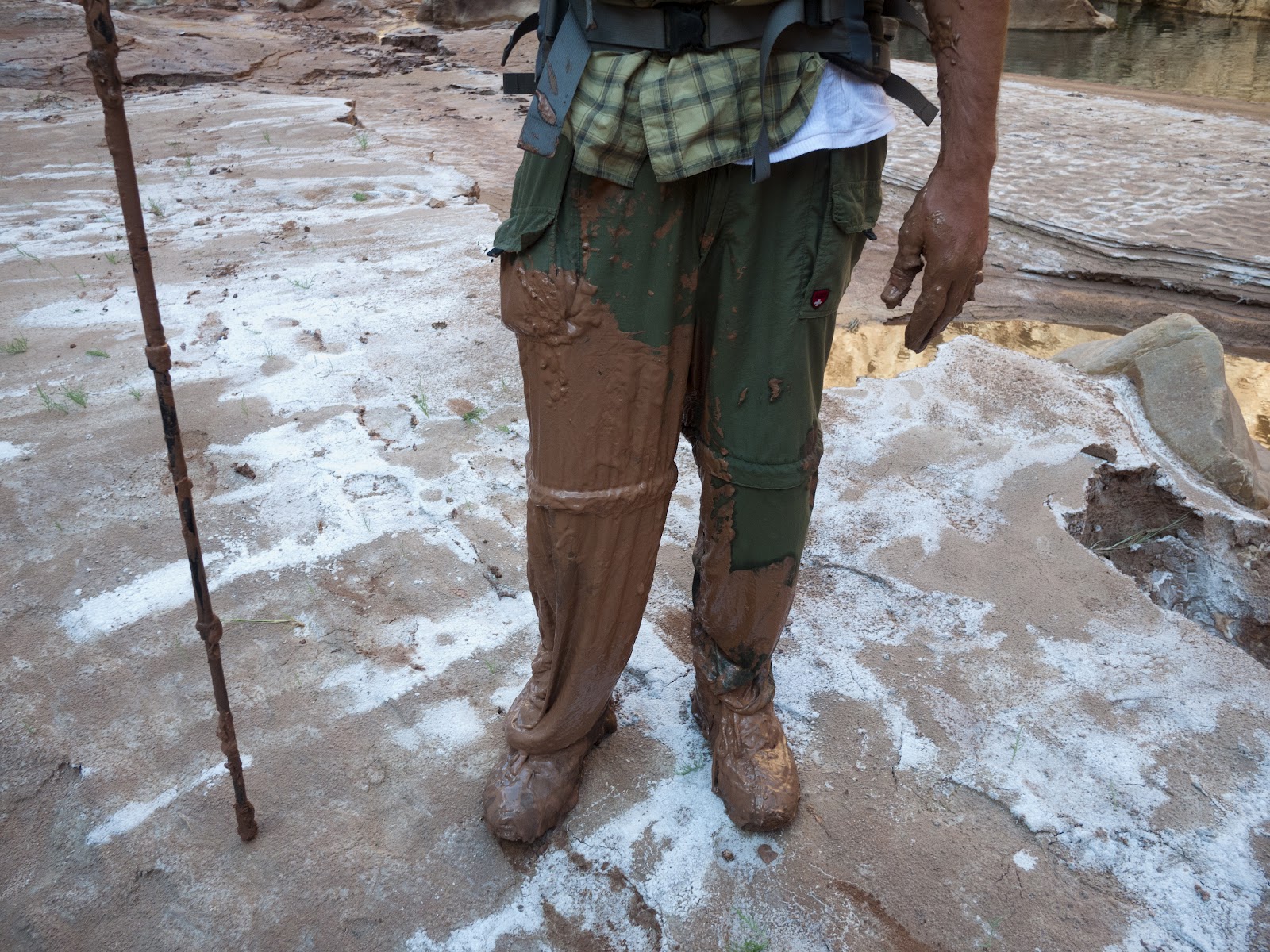
            We cross at a particularly wide though shallow section in the gorge and scramble out of an ankle deep mud pit up onto the shore on the other side.  Locating the trail again we head off downstream only to get off track, spend 45 minutes boulder hopping before Jarrod makes out the trail on the other side.  For the entirety of the two miles to Salt Camp the trail seems to stay on one side of the river, then just abruptly end, signifying a long crossing, repeating this trend multiple times.  It is something to cross in calm shallow turquoise waters mere feet above a thundering travertine waterfall and I caught myself stopping multiple times, mid-river, to take in what was in front of me and to look back up canyon to where we had come from.  If I had not known there had been a small but good trail I would have thought the section behind us was practically impassable.                    

Jarrod enjoying the view


         Eventually we find a good path that stays on canyon right for about half of a mile, eventually climbing a steep sandy hill and, looking down-canyon, can, for the first time, make out Salt Canyon entering the main gorge on river right.  We stop for a second to reflect on what this means.  This small side canyon signifies known territory, and, more importantly, safety.   We are overcome with a prideful giddiness and realize we have only two landmarks left to tick off on our trip, the Hopi Sipapu and the confluence itself.              

Typical crossing for this portion of the hike
             We press on and soon come to the wide mouth of Big Canyon on river right, just above Salt Canyon.  It was here that George Mancuso and Linda Brehmer were killed by an epic flash flood in 2001.  In fact (in typical desert environment flash flood fashion), though the weather was clear where they had been hiking, the flood had been so particularly violent that Mancuso’s body (himself a veteran hiker of Grand Canyon) would be found all the way downstream (roughly 6 miles) at the confluence.  Insignificance pervades my psyche as I stand at the mouth of this huge canyon.  Looking down its throat I try to imagine just what a flash flood here might look like while pondering the sheer raw power that this place possesses.  I realize that my ability to simply imagine the scale of such an event (like when reading the neat placards explaining the geologic evolution of places like Grand Canyon or Yosemite) is murky at best and all I can muster is a fuzzy concept.  I cannot compare it to something I have already seen or experienced because I have never seen or experienced anything close to it.  There is no mental scale that I possess to even begin to associate with such an event.  I reflect for a moment longer and we take off.       

Taking another break to admire the beauty of this section
              Rounding a gentle left hand bend in the canyon we plod a muddy trail and at once a familiarity invades our senses.  We are at Salt Camp.  I hear voices as I walk the small narrow trail up the flat sandy bench shaded by a large tree.  As I come into camp I am met with the curious gaze of several people.  No one speaks; they just seem to stare, wondering whom we are and where we are coming from.  I try to be friendly and explain that we have come down from Cameron and we have friends coming down the Salt Trail that we will be meeting with.  More silence.  I think one of the guys gave a little nod and mumbled an unconcerned “huh.” Eventually the individual sitting in the middle of the group looking rather pissed that we are invading his meditative experience (whom we come to nickname “beardface” or “the beard”) explains that they are with fish and wildlife and because of the prevailing winds their helicopter transport was unable to land and they are stranded for another day (what a tragedy).  Salt camp is rather small and this group is not particularly inviting, it took Jarrod and I all of ten seconds to look at each other and decide to head to the confluence.   

At the mouth of Big Canyon looking at Salt Canyon coming in on the right
             Downing some peanuts on a small beach below the camp we remorse about not seeing our friends tonight as we had imagined a triumphant meet-up, however, after the solitude of our previous days we don’t feel like sharing camp with a huge (and unfriendly) group.                                                   

Travs right above Salt Camp
            Pushing on, we snake our way through the trail that parts the eight-foot tall reeds swaying in the wind.  Eventually we emerge at the river but decide to take a small side trail to the right.  Following this for a while, the trail soon begins to peter out and we are ducking under bushes and climbing over large boulders.  Across the river we see a figure emerge on the bank and stare at us.  We claw our way back down to the river for a calm waist deep crossing.  As we emerge on the other bank the young man asks, “hey, do you guys want some water?”  Surprised, we take him up on his offer as he leads us back to a Fish and Wildlife camp set deep beneath an alcove high up off the river.  In camp, the four youngish people  ask us about our journey.  We explain where we came from and at this time an older, leathery looking gray haired man walks into camp.  We instantly pick up on the fact that he is the boss, or the “beard face,” of this lower camp.  Looking around we realize this is the camp where we had found potable water last year on our way back from the Sipapu and it is interesting to see if fully staffed.  We are again told the story of how the group is “stuck” for another day due to high winds canceling their heli-vac.  I glance over at one of the two tables set up in the shade beneath the overhang and see fresh pink fish on a plate by a knife.  About the time that I spy this treat, one of the volunteers, sensing my lust for real food sees this and shuffles it away.  The group is generally friendly, though the old man, now titled “Old timer” to Jarrod and I, seems hesitant to chat.  We take them up on their offer, refill our waters, and head out.                                   

The view back up-canyon
             The trail heading towards the confluence only gets bigger and more “trail-like” as we make our way downstream.  We figure it must be because many of the rafters stopping at the confluence, a popular spot for commercial rafting trips, come up this far into the canyon to see the Hopi Sipapu.                                                          
                About forty-five minutes after leaving the Fish and Wildlife camp we come to the Sipapu.  It is a particularly special moment for me as I missed out on making it down to this point the previous year.  Jarrod has already seen it and scouts the bank for salt deposit, even tasting a bit.  Though I am burning to get to the confluence, I realize how special it is to be at this place and decide to take the time, ford the river, and get a closer look.  From a distance, and if one did not know better, the Sipapu appears to be a strange apparition, nothing more than a rounded pile of red dirt sitting at the base of a large canyon wall.  In reality, this is a place of great spiritual significance for the Hopi people.  It represents their birthplace; the small recessed bubbling hole overlooking the turquoise waters at the foot of this deep red rocked canyon symbolizes the portal through which their ancient ancestors first emerged to enter the present world.   It is a powerful moment to stand near it and reflect on its importance.                                                                                    
The crossing to the Sipapu
              I cross back over the river to find Jarrod sitting under a nicely shaded spot with pack off.  We are aware that if we get too comfortable now the day will slip away and so decide to take off.  For the next four miles the trail goes away from and stays up off the river.  It is not particularly pretty and the afternoon heat is sweltering as it is reflected off the loose white sand at our feet.  The hiking becomes monotonous again as we miss the cool aesthetic comfort hiking near the river brings us.  We find a deeply shaded space where the trail finally rejoins the path of the river and take our packs off.  We are both sweating profusely and the time spent mindlessly walking with little inspiration has left us drained.  I check the topos and see that around the huge left hand bend in front of us is the confluence.  We chug out water and head out for the final push.                                                 

The Sipapu looking downstream
        As the canyon begins to curve we see large collections of camping gear arranged into nice neat piles.  We looked around for the occupants of what had to be the fourth and final Fish and Wildlife camp but they were nowhere to be seen.  We would learn later that we were supposed to cross the river (from left bank to right bank) here, but the trail was still strong so we continued on.                                                                                  
Fish and Wildlife gear
               Eventually we start to climb up above the river skirting a fluted rock shelf as we looked down to see hordes of rafters enjoying the warm waters of the Little Colorado.  It is a bit of a shock to the system to see so many people gathered in one area, but the realization that we are near the confluence quells any negative feelings we have.  We continue to climb and eventually find a good trail leading back down to the river.  We walk a little further and the trail disappears completely into a patch of tall reeds.  We are ravenous to get to the confluence and hack our way through them, coming out onto a rocky ledge on the downstream side of the confluence.  We follow the ledge for a bit before we realize it is not the right way and that we need to be on the upstream side on the confluence to access good cold water from the Colorado.                                                                                                            
View up-canyon from the rising trail
             We scramble back down to the island and look for a place to cross.  Hiking across the gravelly patch separating the upstream side of the confluence from the downstream side we come out to a spot overlooking a smooth, fast, very deep turquoise tongue roughly fifty feet wide separating us from the most upstream bank.  I am fed up at this point with our difficulties reaching the other shore, but Jarrod is calm and collected and as a group we decide we need to cross here.  We are slightly worried about swimming this section; with its strong current it brings the small possibility of us being swept out to the main body of the Colorado.  As a result, we decide, through much consternation, to take the time and blow up the green pool floats for one last hurrah.   It seems silly to me that we spend what seemed like forever blowing up the tubes to cross such a small section, but they seem to reassure us, making our decision more formal I get mine blown up and walk to the drop off (waist deep) at the edge of the current, as Jarrod, who has already crossed, looks on.  I kick off and with a couple slaps of my legs come up on the other side.                

Jarrod pondering the finer points of what would be our last inner-tube assisted crossing
         We climb up on to the shore and dropping our packs under some shade survey our surroundings.  From where we are standing we have a great view of the confluence; the LCR and its warm turquoise waters flowing gently into the cool, dark green swift currents of the Colorado.  We are here.  The convergence of water in front of us, housed by Grand Canyon National Park proper, represents our destination, our turn around point, and we take a second to let it sink in.

                                                                                            
The confluence!!
        Since the beginning of the trip, even in the initial planning phases, Jarrod and I harbored a secret desire to score some cold beer from a rafting group at the confluence.  Standing on the shore drying off we look back up canyon and see the commercial rafting trip clientele heading back toward their large pontoon boats.  They ask us about our trip, want to know what we are doing out here and how we are going to get back.  We talk for a bit and then two of the women we are in conversation ask us to turn around and begin peeing in the river we are to filter our water out of.               
    
The awesome commercial group
            Turning our backs we see three individuals heading towards the boats; two very fit women and one fit tanned bearded man.  We know instantly that these are the river guides, and, more importantly, the possessors of cold beer.  Being a whitewater boater myself, I am unsure of the kosher rules when it comes to commercial groups and alcohol supply.  Once we enter into conversation though the guides are enthusiastic to hear about our trip and are super friendly; one of them, after talking to her, actually turns out to be Navajo and from Fort Defiance, the small reservation town where Jarrod and I work.  What are the chances?  We hit it off and they take us back to the boats where they refill our waters (now empty) and provide us with 4 ice-cold PBR’s, 2 cokes, and fresh fruit right out of the cooler.  We thank them immensely and scramble up onto a rock ledge to watch them head out.       

The view of the Grand Canyon from our cheers spot
            They float by as the sun is getting low in the sky and we cheers them from a distance.  The ice cold beer tastes more amazing than we ever could have imagined and we both get a slight giggly buzz (2 PBR’s, really?) and reminisce about what it took to get here.  It is an absolutely joyous afternoon, sitting on a ledge above the Colorado River, at the confluence, watching the sun go down while drinking cold beer.               

Cheers!
            We make camp and make a small fire a short distance up-canyon from the Confluence in moderate proximity of two small backpacking groups who came down the Beamer Trail and whom will head back out the Tanner Trail.  We stay up late, watching the stars come alive over the open flame of our fire and take comfort in the fact that we only have six miles to hike tomorrow and that we will be meeting up with our friends.  For the second night in a row, sleep comes fast and effortlessly and is incredibly peaceful in nature. 

Late light in the canyon from camp


Jarrod getting nice and comfy


Read More

7/3/12

Little Colorado: Cameron to Confluence Part 4

Little Colorado Part 4:
Horse Trail to River Camp 


We woke up the third morning emboldened by the fact that we had made it to our cache and that we would actually have time to enjoy the upcoming portion of the journey.  We had been told by countless sources that the section from the Horse Trail to Salt Canyon was the most spectacular of the entire trip and we were eager to see for ourselves.

Sorting the cache and making breakfast.  Super excited for hot coffee!!
Having to only make six to eight miles we let ourselves sleep in and took comfort in the lazy morning and huge cooked breakfast we consumed.  By this time we were both quite sick of the protein bars, which had been our staple food for the last two days, and could not believe how much a hot meal and coffee could affect ones mental well being for the better.  After breakfast we packed up and headed out as the first rays of sun touched the canyon floor  

Jarrod enjoying the leisurely morning
The four miles from camp to Blue Springs were quite enjoyable.  There were a few crossings here and there but we became proficient at cutting the corners of the small river we were traveling with and made good time.  About a half mile above Blue Springs, the environment changed dramatically.  Again.  Bill Orman had warned us about this section due to it resembling “Quicksand Alley” in its “quicksandness” I have to admit, Jarrod and I were so sure it was going to be dry we didn’t pay too much attention to it.  

Looking down canyon from camp
We came around a right bend in the canyon, downstream from a sheer face where a number of new springs were adding water to the ever-growing river and were met with a long narrow section of wall to wall mud.  We did our best to stay together in the middle of the canyon but could not help but encounter large deep sections of quicksand sinkholes.  Eventually we made a left hand turn and had to hop to a particularly muddy island in the center of the river.  We knew Blue Springs had to be close as we came to the realization that we were in the very section Orman had warned us about.

Jarrod coming into the second "Quicksand Alley" above Blue Springs
Slowly moving down canyon we tried to find solid rock to stand on.  At one point I looked back and Jarrod had a hit a spot of quicksand up to his waist.  We decided to take a little break (as seemed to be our usual protocol once things got tough).  Eventually we came to a river-wide house sized rock blockage.  We had to inch our way down between the massive boulders on far river left before crossing back to canyon right.   By this point we were in head down and move mode and I ended up walking right by Blue Springs itself!

Misstep
I stopped just downstream, took off my pack for a break, and thought to myself, “huh, it looks like there is a lot more water in the river all of a sudden.”  Jarrod came around the corner and said, “Hey, did you see the Spring?”  I told him I hadn’t and walked back upstream to get a glimpse.  

Blue Springs.  There is great sandy beach here that would make an awesome camp.  Next time.
Blue Springs is a truly special place.  It is the source for the year round flows and turquoise water that the LCR is so known for.  It was incredible to see it bubbling up from a head wall on Canyon left and I was able to sit and ponder on how singularly amazing it was to see this place, that because of the difficulty in reaching it, few ever see.  As I sat and took it in I gazed high up on the canyon wall behind the Spring, scouting for signs of the elusive, and supposedly very difficult and exposed “Blue Springs route,” but did not find any markers distinguishing it.  I would not be sharing this spot with anyone else this day.  

Looking down canyon from Blue Spring, the official beginning of the LCR.
Down-canyon from Blue Springs things slowed down dramatically, but became really fun.  The river was now running a solid 3-400CFS as it made its way to the confluence in Grand Canyon.  We spent the next few hours boulder hopping, crossing in swift waist deep currents, and gawking at absolutely incredible, pristine scenery that made us constantly talk about how we wished we had more time.  Tall red sheer walled sandstone cliffs plunged straight down into the turquoise blue waters of the LCR, bounded by occasional white sandy beaches.  Eventually, about two miles down canyon from Blue Springs, our path petered out into chest deep water.  It was time to get out the inflatables.

Heading down canyon with good easy walking
Based on some awesome advice I had received pre-trip, we decided to purchase very cheap but light pool doughnuts.  They had been included in our cache at Horse Trail and I originally thought we may use them briefly, but didn’t take them very seriously in our initial planning.  We had finally come to a place in the canyon however that warranted their use.  Downstream of where we were standing the current picked up dramatically and, because the river was already just over waist deep, a stand-alone crossing didn’t seem to doable.  This, taken in conjunction with the fact that we were both very hot and wanted a break from the heavy packs, served as a catalyst for inflating (which was a long, slow, pain in the ass) the tubes and floating the packs.

First pack-float
We had lined the inside of our packs that morning with trash compactor bags and had put all of our electronics in an NRS dry bag, which we had also cached.  Thankfully Jarrod had brought a waterproof camera for just this stretch or there would have been no photo/video documentation!
After what seemed like an hour of blowing up the tubes, we looked at each other with an excited, schoolboy like giddiness.  Jarrod would stay back and film as I attempted the first official pack float.  Now, I can honestly say, I was so excited to try this I didn’t really think about the finer points of physically carrying out said “floating.”  Walking out into the current I eventually came to a point where the swift current was pushing me downstream at a chest level and, with my pack not so firmly secured to the tube, “let go.”  At first it went great, I thought to myself, “Hey I am making distance without having to do any work!”  I looked up canyon and saw Jarrod putting in behind me.  It was at this point that amateur hour began.  Jarrod dropped an earplug and in my attempt to grab it as it floated towards me (I was flailing around like a little kid who didn’t know how to swim) my pack fell off my inner tube and I lost contact with both pack and tube. 
Realizing that I could not touch the river bottom and that I could only grab one object before losing contact with both I naturally grabbed my pack as the inner tube took off by itself down river.  I had also missed grabbing the earplug.  I swam frantically towards the rocky shore and checked my backpack to make sure nothing vital had been lost.  Instantly I realized I had lost one of my potable water bottles (1.5 liters and half of my remaining supply!).  I tried to let my frustration go as I thought about how much it would have sucked to have lost my entire bag.  Jarrod and I regrouped, found a good place to cross back to a long rocky stretch on canyon left and headed on.

Typical amazing scenery in this stretch
A little down canyon we came to a beautiful sandy beach overlooking a particularly gorgeous calm and deep turquoise pool.  There, sitting on the beach and gently rocking in the water sat my little green pool doughnut, looking almost as if someone had parked it there.  Shortly after which Jarrod yelled down canyon that he could see my water bottle bobbing in the current and coming towards me.  Eventually I saw it, dropped my pack, and swam out to the center of the river to retrieve it.  We both took this as Karma.  A year ago, during a river crossing coming back from the Sipapu, Jarrod had dropped his camera right in the center of the river.  Out of pure luck I had reached down, and just feeling around, had found it laying on a rock.  The camera was broken but the memory card (which held pictures from his recent trip to Europe) was ok.
We decided to take a quick lunch break.  It had been hard hiking since Blue Spring but was some of the most enjoyable I had ever experienced.  20 people could hike the section we had done and every single one of them could have a different way of getting to the rocky beach we were now sitting on eating our food.  Not having a trail or path to aid in our thought process forced us to make decisions as a team about where to cross, which route to take, and what looked like it might go.  It didn’t always work out and there were multiple times where we both realized that the particular path we had chosen was the wrong one.  But we never got frustrated, if anything, it made us more determined to find a way, adding to the sense of adventure and providing us with a cheerful sense of accomplishment when we did progress. We were the ones making the calls on where to go and how to get there. 

Me at the start of the long float section
Pushing off again we came to a sharp L hand bend and stopped at rivers edge.  There was nowhere to cross and the river appeared to be the deepest we had yet seen.  We scratched our heads and decided to blow up the doughnuts again.  After doing so we walked into the river to the point where we could not touch.  I had finally figured out a great way to travel with my pack on the tube and was no longer worried about losing it.  We were also in a particularly calm stretch of the canyon with a mild current and no rocks to provide obstacles.  We ended up floating for quite a long stretch and I remember looking up, watching the canyon pass by me as the river took us onward, and, for the first time on the trip, being completely present in the moment.  It was such an odd feeling to be moving without having to expel any energy and I felt as though I were literally floating down canyon.  Time seemed to slow down, the world became silent as I was allowed to simply look around and take the canyon in. 

Jarrod's vantage point as we continue down-canyon on the long float.
Eventually we came around a sharp R handed bend and noticed two cots set up on a sandy beach on river left.  We walked out of the water briefly to look over the camp, but noticed there were no people occupying it, and put back into the river.  We floated a short while longer and eventually noticed a young man sitting in a lawn chair listening to satellite radio.  We got out of the water and walking up to him he looked at us with a curious amusement.  We learned he worked for Fish and Wildlife doing work restoring the native Humpback Chub population and that this was the most up-canyon camp of the four that dotted the lower river.  What was crazy is that he was from Hood River, Oregon, about an hour from where I grew up.  He obviously was way too comfortable, not working at all, and we got the vibe he wanted to be left alone, so we headed out.  Before we left, as we were about to get back in the river he yelled while pointing to canyon R, “hey, there is a trail from here all the way to the helicopter pad at Salt Canyon if you want to take it.”  We could not believe our ears.
After hiking for 3 days and 50+ miles of trail-less wilderness, coming upon a trail was a surreal experience.  We were so used to making our own decision as to where to go, moving at a snails pace, and picking up on signs of animal trails that finding hard packed trail completely changed the dynamic of our trip.  We flew!  In fact, we couldn’t believe how easy and fast it really was.  After a long day of crossings and scrambling we were reinvigorated and kept yelling to each other how awesome this was.  We continued to fly down canyon, following the narrow trail hacked out in the forest of reeds, for another mile or two. 
Though we were enjoying the trail at the time, at the same time we lost touch with the canyon.  What had previously been a journey of decisions, evaluated on the fly in an attempt to find the path of least resistance became a spoon-fed defined and constrained passage.  In losing touch with the canyon we substituted difficult slow miles for fast easy miles, and in doing so our senses, so heightened over the previous days trek became dulled and blunted.  We also no longer interacted with the environment in the way we had previously.  Before hand, we would come to spots where an obstruction would present itself in some form and have to really survey the land, analyzing the geography before making a decision and (frequently) have to deal with the frustration of making the wrong call.  Now, we had no decisions to make, they were already made for us, all we had to do was walk.  We detached from our surroundings, looking only ahead at the packed dirt trail ahead of us instead of at what surrounded us.  As bad as it sounds, at that moment, late in the afternoon on the third day, we did not care.  The trail seemed like the greatest thing to us as all we cared about was making good time.

The view from the third nights' camp
Eventually we came to a small sandy beach on canyon L just big enough for our two small tents. The campsite we chose was so intimate, and was so different than the typical backcountry campground in the SW, surrounded by other hikers who had applied for their permit months in advance in order to secure a designated camp-site where fires were not allowed.  At the base of a huge travertine waterfall we built a small fire, dried our clothes, reminisced about the previous three days, and, for the first time since leaving Cameron, got to enjoy the late afternoon. We were two miles above Salt Camp, we had trail from here to the confluence, we felt truly safe and for the first time, what we had done the previous days really sank in.  

Getting the fire going and drying out
We stayed up late, listening to the falls reverberate off the canyon walls, taking in the massive starry sky and eating, drinking, and laughing until we could stand it no longer.  It would be the last night where it would be just the two us, where the canyon still felt “wild,” and our last taste of the overwhelming peace that I imagine accompanies such raw environments.  The sleep I had that night was the deepest and most satisfying I’d had in a long while.  Tomorrow we would be at the confluence. 

Read More
Theme images by Jason Morrow. Powered by Blogger.

Definition List

Popular Posts

© 2011 Beyond the Wall, AllRightsReserved.

Designed by ScreenWritersArena